


Anglesey Shore Dives
This page describes the different shore dives on Anglesey and Holy Island.
The titles are all hyperlinked to Googlemaps, and it’s organised by area;
Holy Island West Coast, Holy Island North Coast, Anglesey North Coast, Anglesey South Coast/Menai Strait, Anglesey West Coast, Anglesey East Coast
Each entry shows you how to access the dive site, what the parking is like, if there’s a nearby public loo and if there’s a slipway that you can launch from.
All the photos were taken around low tide on springs, so you can assess which site is best for you depending on the wind and tide on the day of your dive.
Let us know what you think via the Contact Us form.
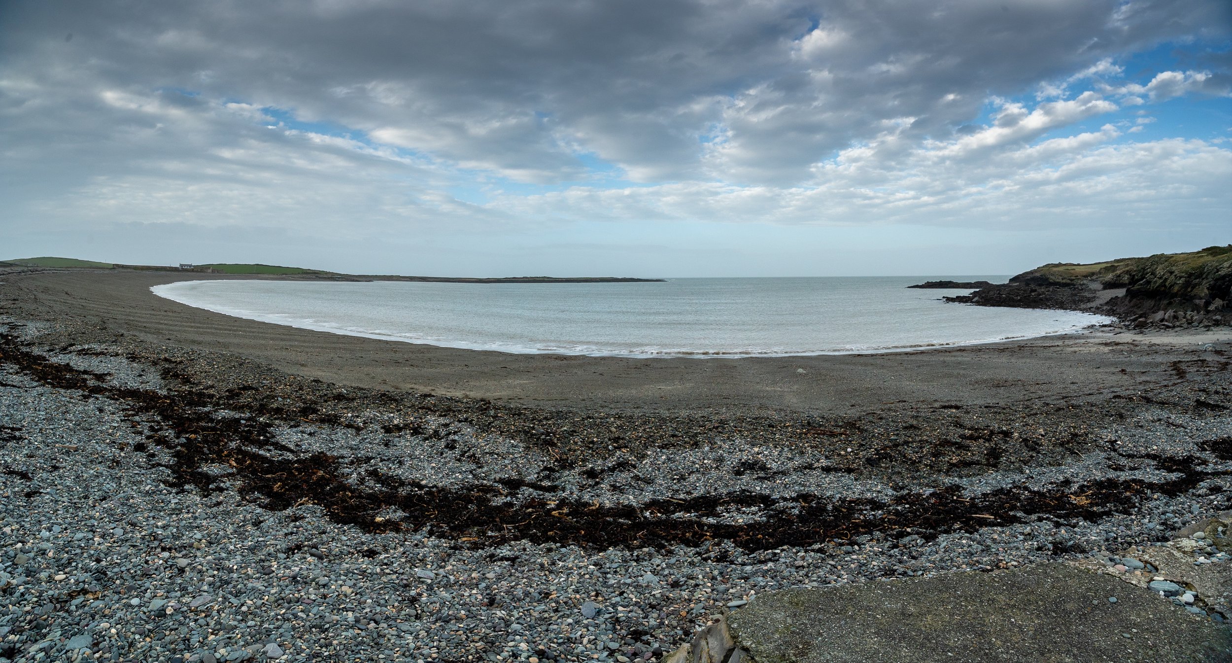
Holy Island West Coast
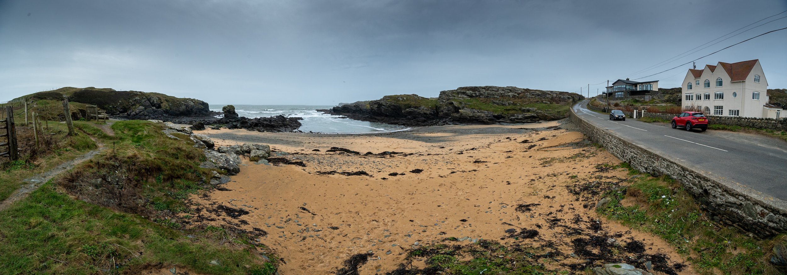
Trearddur Bay
53.280267, -4.620830, https://w3w.co/cloth.hubcaps.soda
This site has a slipway that you can use to launch your boat, and a Council run car park for trailers. You can easily access all of the West coast from here.
If you have a suitable vehicle, then you can launch and recover yourself, or there is a tractor available for a fee.
In the summer, the car park is pay and display. Prices are available from Anglesey County Council.
The nearest public toilet is next to the Sea Shanty restaurant, which also has a car park (but not for trailers).
To the right of the slipway is a really nice shore dive, full of seaweeds, fish and other animals.
When the the slipway is busy you may be asked to use an SMB if diving here.

Slipway

Slipway

You can launch from here with a 4x4, or pay for the tractor to launch you

Shore dive is to the right of the slipway

Anglesey Council regs
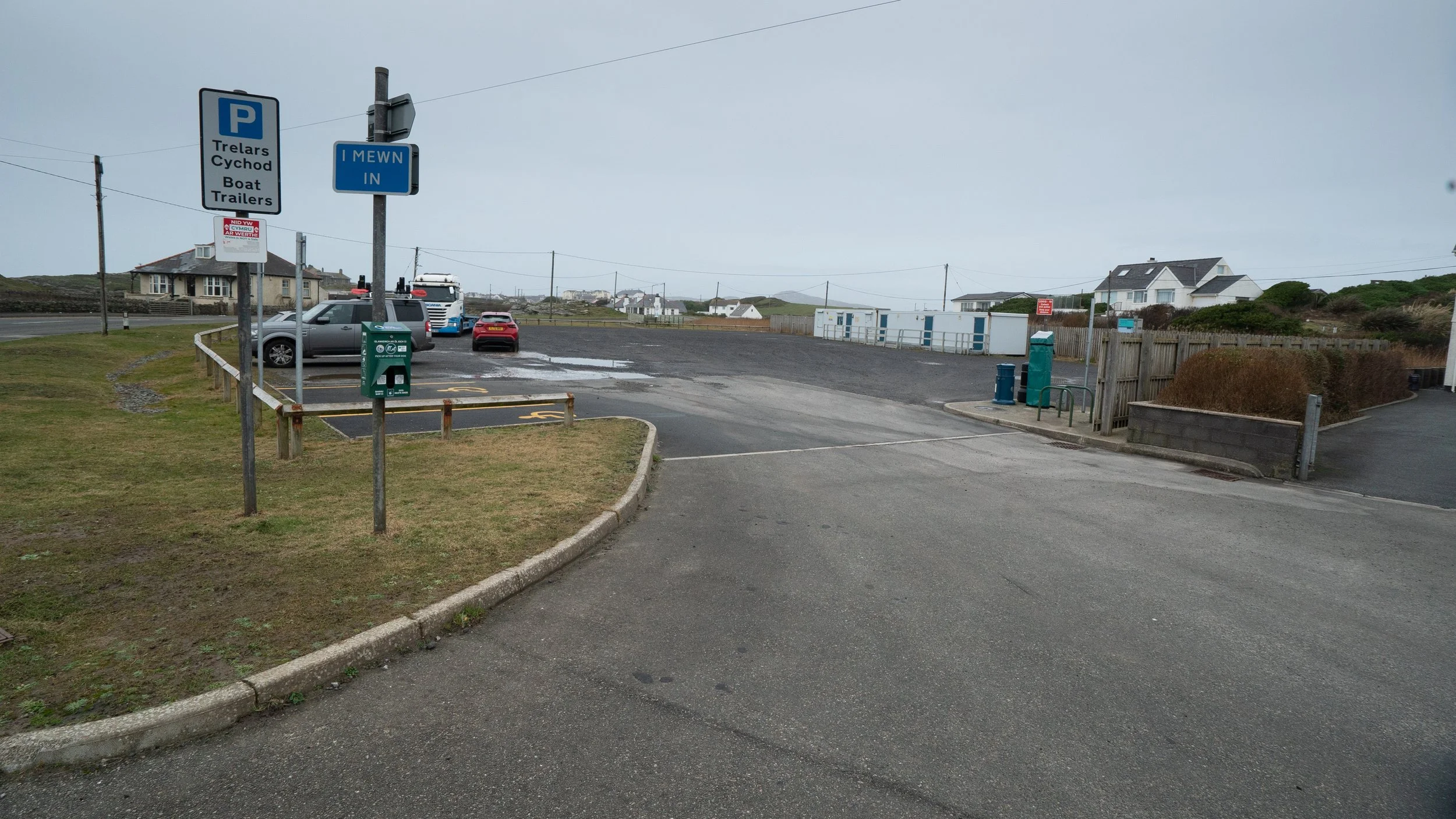
The council trailer park
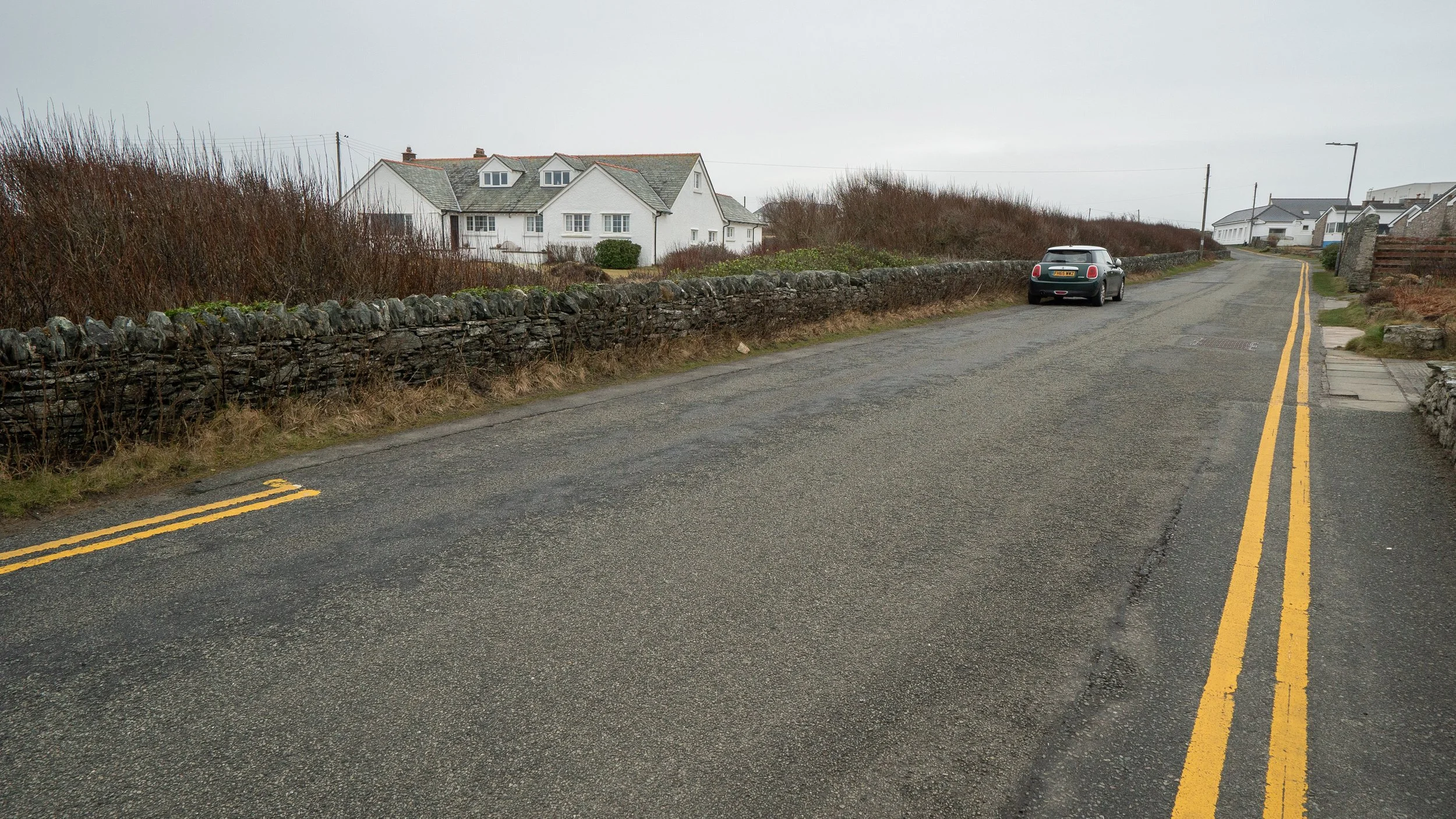
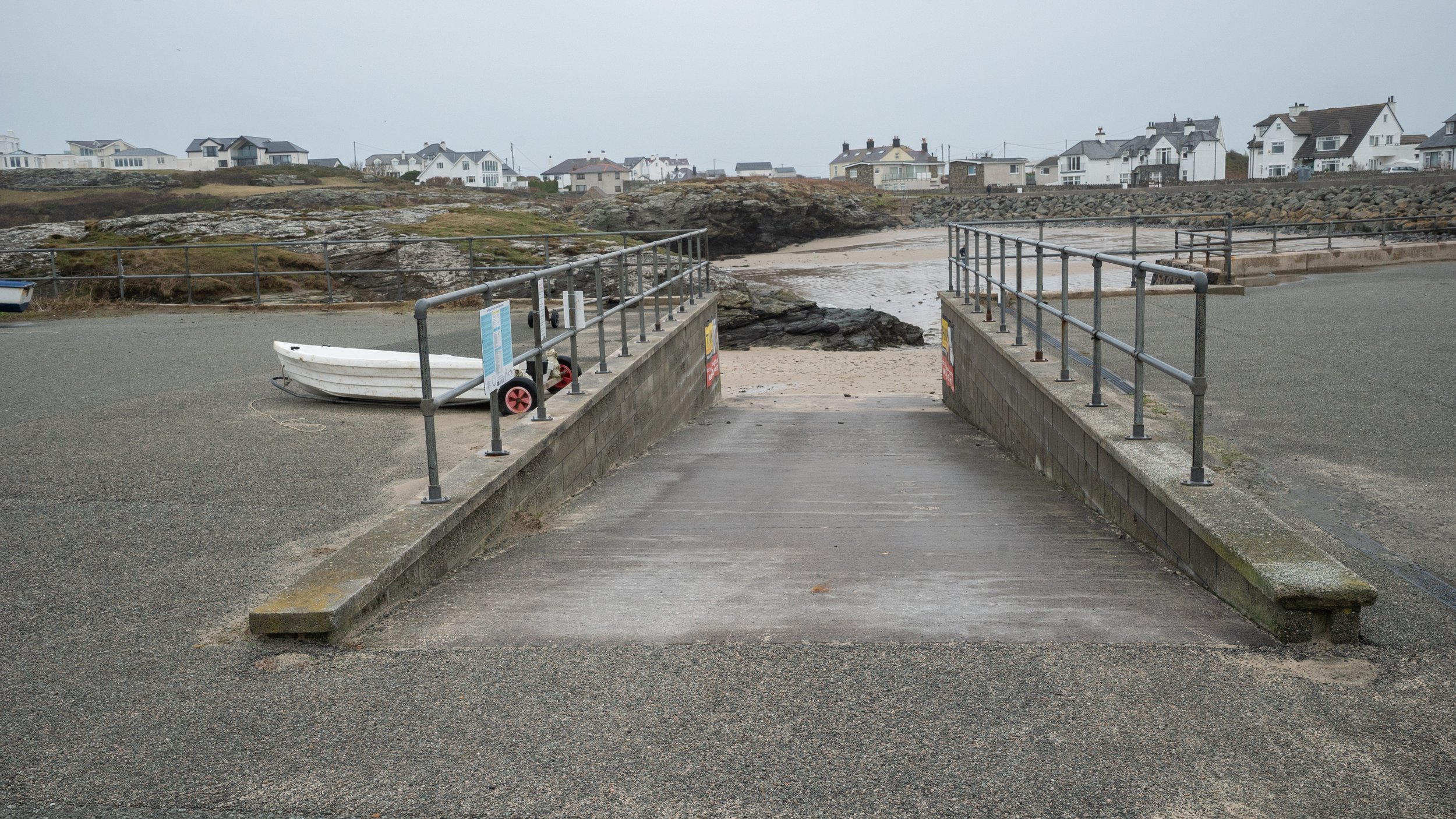
Porth Castell and Diana
53.271506, -4.621688, https://w3w.co/narrate.alright.driftwood
Porth Castell (on the left with the old Diving services shop behind you) is a shallow dive in a very sheltered bay that often has reasonable viz when others do not.
It’s easy to find opposite the old Diving Services shop.
The only parking is up the hill, so you need to drop your kit off by the steps and then go up and round the corner to park.
It’s best dived at high tide, when it’s about 5m deep.
There’s a gully to the left that leads out into deeper water and the cliffs at Ravenspoint.
To the right is Porth Diana that is also used for mooring boats in the summer.
There’s also hard standing for small boats and a slipway, but this can’t be used for launching private boats.

Porth Diana

The old dive shop opposite the dive site

Steps down onto the beach

Gully leading out towards Ravenspoint

Gully leading out to Ravenspoint

View out towards Trearrdur Bay

Gully around the back of Porth Diana going to the little bay next door
Car parking further up the road
Slipway from the boat park down to the beach next door
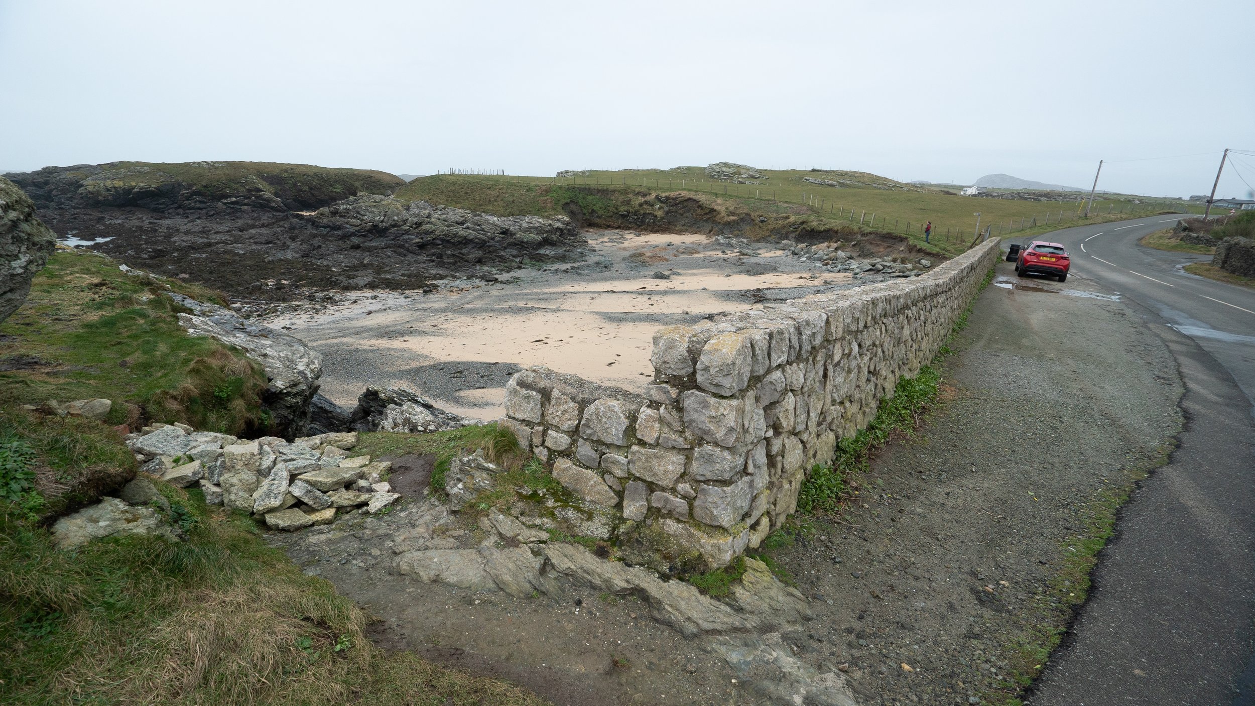
Porth y Pwll
53.281894, -4.635493, ///knowledge.mess.quilt
This small bay is on the left hand side in between Trearrdur Bay and Porth Dafarch.
There’s parking next to the wall, and steps down.
On weekends in the summer, the parking is often occupied by camper vans, so it can be difficult to get a spot.


Central channel with rocks either side

Access to the beach
Parking for a few cars is alongside the wall
Porth Y Post
53.284500, -4.637318, ///cooked.blush.cubic
This small bay is a bit further along from Porth y Pwll.
The parking on the opposite side of the street will only fit three or four cars, and is often taken up with camper vans in the summer.


Porth Dafarch
53.287429, -4.651296, ///skewing.sneezed.position
Porth Dafarch is a firm favourite, particularly for bringing Ocean Divers and introducing them to the sea.
The sand forms convenient ripples at right angles to the beach, so it’s a good place to learn to navigate and do some pilotage.
At high tide the entry/exit is easy, and there’s lots of space to put kit on the stone benches and get ready.
It also boasts a public toilet which has a cold water shower round the back.
In summer the area immediately behind the stone benches is closed off with bollards, and there is a hamburger van there.
It’s very popular with kayakers as well, and families come down to spend the day there, so although there is a lot of parking, there’s a high demand as well.
In high season it often becomes jammed with camper vans on the weekend, putting a squeeze on parking available for day trippers, so arriving early is recommended.


Drop kit off on the stone benches at the bottom of the road

The benches are a sunny spot in the afternoon to do shore cover from

There's a sandy bottom that's useful for teaching pilotage by sand ripples. Kelp and fishes are further out

There's parking all along the wall. The left hand side is for bringing trailers down and unloading kayaks

The slipway works well for kayaks, it's not suitable for launching RHIBs

There's additional parking before you get to the road down to the beach

The public toilets are open in summer. There's a cold water shower round the back for rinsing kit. See Anglesey Council website for details
Rhoscolyn/Porth Wen
53.245089, -4.589139, https://w3w.co/workforce.pavilions.finders
Rhoscolyn Beach is another shallow shore dive with lots to see.
Two seagrass beds have been recorded here, by the rock in the centre, and over towards the far side.
Access is via a single track road that we counted 11 right angled bends on, so although it is technically possible to launch a boat from here, it would be a real challenge to get the trailer in and out if you met someone coming the other way with a similar idea.
Trearrdur Bay is well set up for boats and trailers, so that’s a much safer bet.
The site is well used and gets a lot of kayakers and groups in the summer, and the car park usually fills up by ~9:00.
You have to go past the White Eagle pub to get here, and it’s well worth a visit. The food is good, if a little pricey, and they have a very big garden for drinking beer in.

The seagrass beds are out near the rocks

Rhoscolyn Beach

Entry/exit to the left of the car park

Car park

Entry to the beach on the right of the car park
Holy Island North Coast
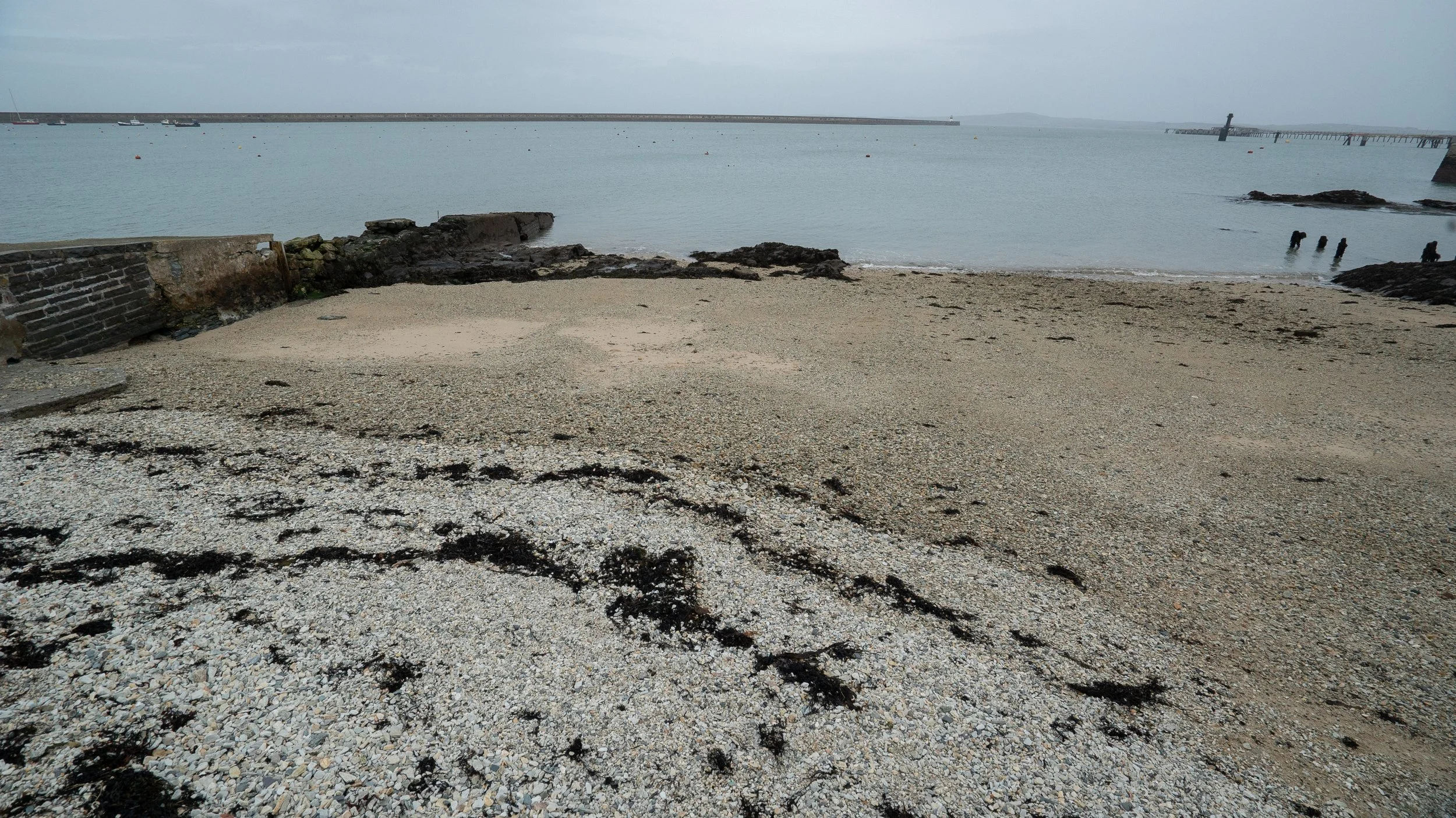
Newry Beach
53.316904, -4.636272, ///hoofs.pavilions.positions
Possibly one of the most frequently dives sites in Anglesey.
Newry Beach is the best sheltered dive site, and can be the only place with any viz left when the weather turns stormy.
The access is easy, and this is a brilliant dive for novices. There’s lots to see, and if you’re lucky there’ll be a scallop swimming by.
The scallops have been tested for contaminants, and they do contain heavy metals, so it’s a good idea to leave them there and buy yourself scallops that are guaranteed to be clean.
For a bit more depth and a change of scenery, you can also go in off the end of MacKenzie Pier.
It’s also possible to go in to the left of the groin where there are some steps, although they are a bit slippy.
This is a good spot for checking weights as it’s easy for a helper to be on the steps handing you lumps of lead
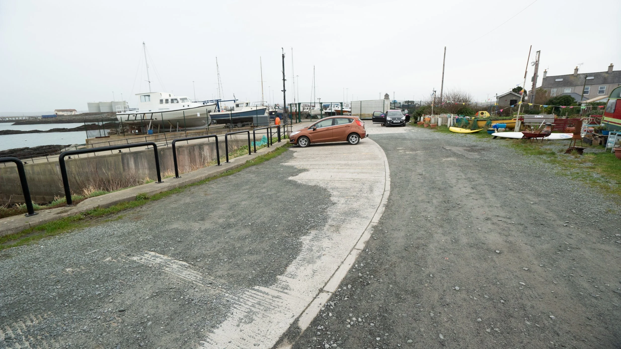
You can go down past the maritime museum and park directly alongside the little slipway, which isn’t any use for launching a RHIB.
If you are bringing your own boat, there’s a public slipway a bit further along at Porth Thomas Hughes, or you can use the Sailing Club slipway for a small fee.


Maritime museum

Stone steps-can be a bit slippy

Newry Beach

Public toilets
Beach leading into the harbour

The steps at the end of MacKenzie Pier

Concrete slipway
Porth Thomas Hughes
53.315312, -4.629985, ///ourselves.chosen.laminated
A small bay with easy access next to the public slipway.
There’s kelp and its associated animals to start with, and heading due north will take you out into the harbour where you will find sea pens.

Public slipway
Parking for several cars
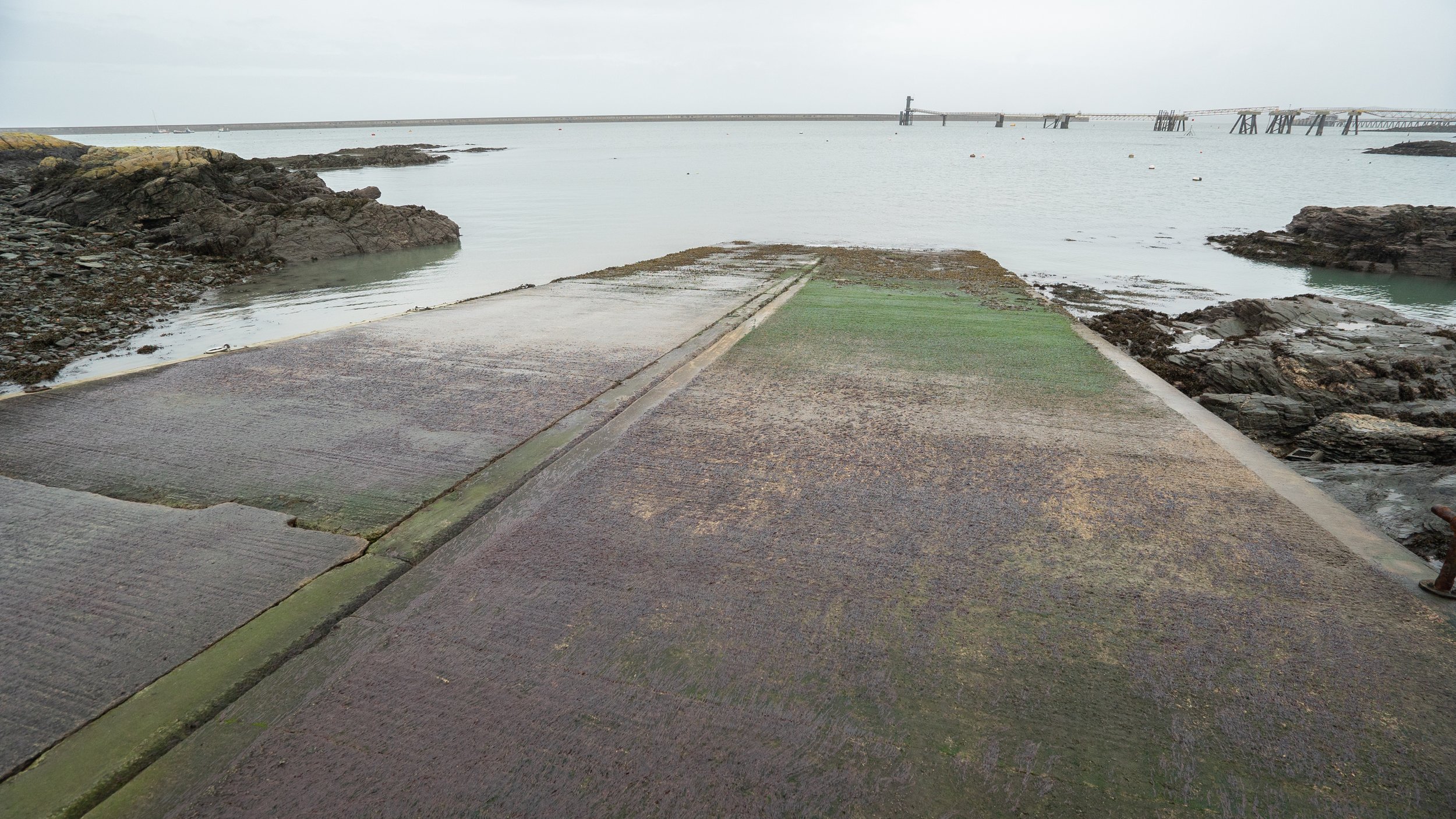
The bottom of the slipway is very slippery, and the end can be completely exposed at low tide

It's next to the allotments, and there are some spaces on the verge to leave a trailer

There are stone steps down to the beach

Entrance
Anglesey North Coast
Cemlyn Bay
53.408867, -4.504926, ///darker.behind.simulates
The beach here is pebbly, and has a steep bank.
There’s lots of seaweed and some dogfish and crabs to see.
A good one to have as an option if the wind has been blowing from the south for a while


Cemaes Bay
53.414660, -4.454993, ///ranks.musically.important
Cemaes Bay gets very empty at low tide, but can make a nice snorkel/shallow dive when the tide is in.
The slipway is available for public use, but launching and retrieving there can be a bit of a dark art.

Looking back to the slipway from the beach

Parking

Cemaes beach

Slipway

Beachfront parking
Bull Bay
53.422255, -4.370373, ///chitchat.evolves.regretted
The slipway at Bull Bay is opposite the rowing club, and launching a boat here gives access to both the north and the east coasts of Anglesey.
It is possible to do it as a shore dive if you fancy something shallow with easy access.
There’s some parking along the beach front, and a small car park around the corner.
There’s also a set of public loos around the corner, making this a good option on a day with a westerly wind.


Anglesey South Coast, Menai Strait
Menai Bridge Nature Trail
53.221587, -4.164595, https://w3w.co/mass.misted.clipboard
The high flow of water through the Strait every day makes it a fantastic dive for critter spotters.
There’s sponges, anenomes, crabs galore, the odd conger eel tucked into a crevice, lobsters snapping their claws at you and even the occasional octopus.
To calculate slack, find low water at Albert dock, and slack in the Strait is 3&1/4 hours before.
Slack can last for up to an hour on a really good neap tide, but will only get you ~30 minutes on Springs before the tide starts to run again.
There is very limited parking available, so you may need to be prepared to drop your kit off and park your car further away.

Entry to the steps down to the beach

Skinny steps to get back up

Entry/exit point

Cable just about visible going into the Strait

Entry/exit point the other side of the bridge. Involves climbing down from the ledge to get onto the beach

A rocky walk out to Pig Island

The foot of the bridge sits on Pig Island, which is hooching with beautiful creatures. The 'Nature Trail' goes around it

Parking under the arches of the bridge is very limited
Porth Y Wrach/ Perch Rock
53.223819, -4.161301 ///titles.craftsman.slate
Access to the shore dive here is really straightforward, you just walk down the slipway and take a line to the east side of Perch rock. Then swim around the rock on the south side, poking into the little nooks and crannies that you find there. The area between Perch rock and the shore is very shallow and full of kelp, so it can be easier to swim around to the most westerly point, and then go back the way that you came.
To calculate slack water in the Strait, look up low water in Albert Dock, and slack in the Strait is 3&1/4 hours before.
If you get there in advance and are ready to go, then you can easily see when the water stops running by the splashing on the rock.
Anyone can launch from the slipway at Porth Y Wrach, but it gets very busy during high season. There is a tractor that you can get to launch your boat if you don’t have an appropriate vehicle.
Be warned: the car park is regularly under water at high tide on springs, so this is not somewhere to leave your vehicle after your dive and go to the pub!


Car and trailer park

Slipway

Be warned!

Slipway looking out to Perch Rock

Three car parking spaces on the road

Slipway
Nelson’s Column
53.216620, -4.192819, ///ending.padlock.shred
Just past Britannia Bridge is Nelson’s column, which offers a shore dive into the centre of the Strait.
To calculate slack water, find low tide at Albert Dock and subtract 3&1/4 hours.
You’ll get a longer (~45minute) dive on neaps before the current starts to tug. A spring tide will only get you about 30 minutes.
There’s plenty of parking next to St Mary’s Church, and then you walk through the graveyard down to the beach.
It can be slippery when wet, so choose your day wisely.

Steps through the graveyard

Path down to the Strait

Path down to the Strait

Entry via the beach

Walk through the graveyard

Kissing gate to the left, or through the main gate by the parking
Coleg Normal
53.223753, -4.153355, ///enjoys.warp.treble
To access this site, you go on the south side of the Strait through Bangor University Coleg Normal (Normal Site).
The parking is always full during term time, and there is no other parking anywhere, so diving can only happen on a weekend or outside of term time.
You walk down through the woods with your gear on, and it can be very slippery when wet. There’s some uneven rocks at the end of the path, again difficult to walk on with kit on.
The entry to the site is by the big square block, and then you head off to the right (east).
The seabed descends gradually, then goes down a slope to ~15m
As with all Strait dives, there’s loads to see with lots of sponges, crabs etc.

Uneven steps down to the beach

Entry is by the square rock

The path can be slippery and difficult to walk on with heavy gear

Path down through the woods

Beginning of the path

Parking when the University is not open
Anglesey West Coast
Porth Trecastell/Cable Bay
53.206998, -4.498900, ///hides.household.gateway
This little bay is full of life.
There’s fish and seaweeds and crabs, we’ve seen pipefish here and all manner of other animals.
It’s a lovely place to bring novice divers if you want them to have a great experience.
It does face due west and so can be murky, so you will need to pick your tide/wind well to get the best conditions


Walk over the dunes to a protected shallow bay

Car parking that is in the process of being upgraded to have a height restricted barrier, and space for a food van

Pay and display parking
Rhosneigr Beach
53.229192, -4.523228, https://w3w.co/uttering.earth.invested
Rhosneigr is very shallow, and the sand stretches out a long way.
The rocky reefs that you can see at low tide make for an interesting dive, and it’s well worth a visit.
It is possible to launch and recover here, but the sand has a reputation for being very soft, so it’s advisable to use the tractor.
The only place to leave a trailer is high up the beach, and car parking is in the couple of streets that go down to the beach.
Launching here gives easy access to Rhoscolyn reef, and also to the less dived inlets heading South.

Southerly beach entry/exit

Path to the Southerly beach

Council slipway, tractor launch and recovery are available in summer

An intertidal rocky reef to explore at high tide

Council slipway

Access from Beach Road. The bottom of the road has bollards to stop trailers using the slipway

Rhosneigr beach and the bollards at the bottom of Beach Road

Old RNLI boathouse next to the Council slipway
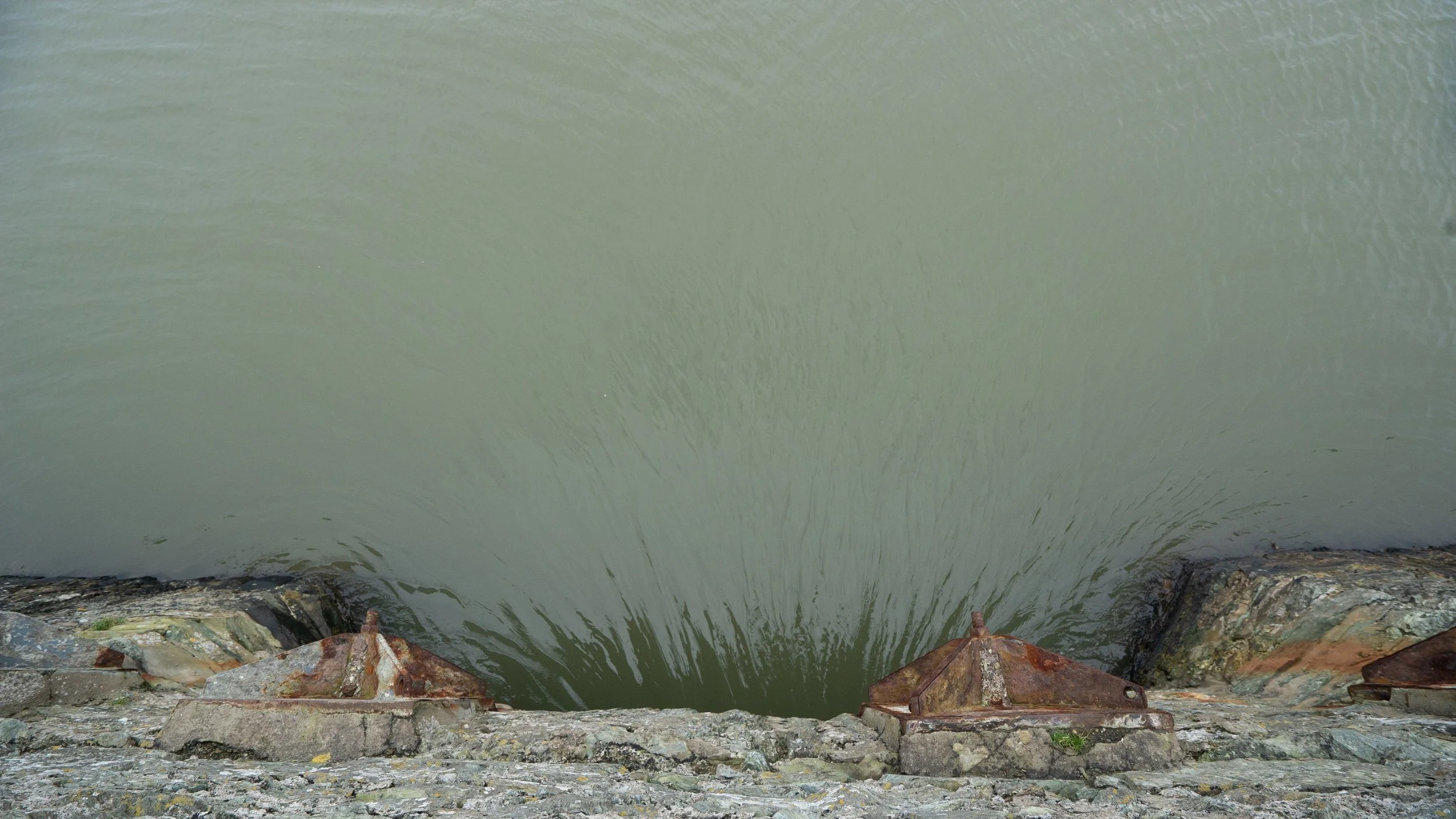
Inland Sea
53.274727, -4.580133, ///ridiculed.covertly.envelope
The inland sea stays very shallow, but there is a hole that you can sit in where the water flows under the bridge that has been scoured out by the current.
So you sit in the hole and watch the water flow over your head.
There’s sea grass beds in the sea, if you fancy mooching about in 1-2m of water.


Steps back up to the road

On road parking

Entry point

Water flowing through the channel in the bridge

Access to the entry point
Water flowing under the bridge. Excellent site for pooh sticks

Anglesey East Coast
Porth Eilian
53.411679, -4.293065, ///deaf.disposing.flip
This is a fairly shallow dive that, along with the rest of Liverpool Bay, can be prone to poor viz, but if the wind has been blowing from the west it can be a really good choice.
On a good day it’s lovely, and a nice dive to take novices to.
The car park is further up the hill, so you need to drop kit off at the bottom, and then take your car away.
There’s a public toilet near the car park as well.

Entry to the beach

Slipway

Drop off area for kit

Car park at top of hill